Going Big in Little Town by Mike Bartick
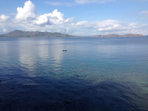
Landlocked and daydreaming, I am staring across the calm waters of Balayan bay riding out the big “Q” that the rest of the planet is now enduring. I am lucky enough to call the Anilao area home and have lived here for the better part of 10 or more years, during which I have conservatively logged more than 4000+ dives. This experience has given me an in-depth view above and below the waterline.
Please join me as I dry-dive into some of the area’s healthiest and most vibrant reefs and seascapes and discover why the Verde Island Pass is so essential here.
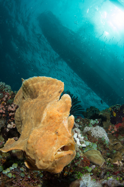
“Going Big in Tiny Town” has been a lingering idea where I’ve wanted to showcase a few of the stunning reefs around the Anilao area. My concept could also be described as an attempt to provide a broad view of why the area is so rich with marine life, from its geology to its ecology. The thing is, that most of my dives done here in Anilao are with macro lenses due to the nature of my obsession but please don’t get me wrong. I love exploring more than anything, and to get a full and accurate picture cannot be achieved through a macro lens. A big picture overview is needed to get a handle on what is happening in this tiny little place that has become more like laboratory for me than anything else.
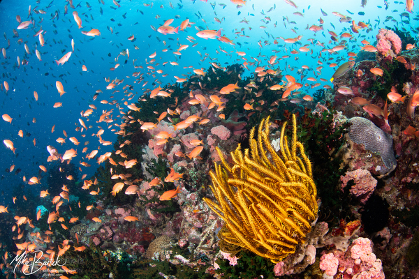
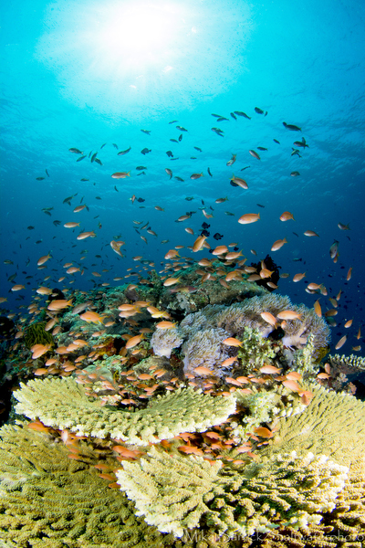
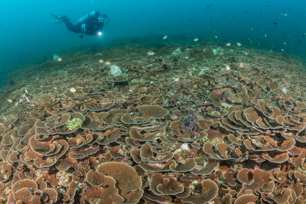
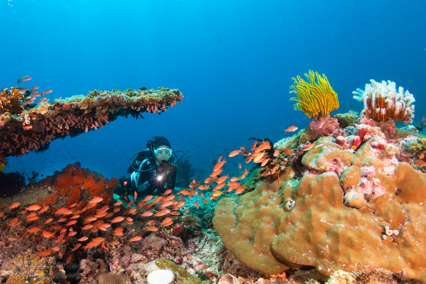
Anilao is well known for its macro diving now and has risen in the ranks to be one of the best macro dive destinations on the globe. But what most people don’t realize is that this tiny peninsula is also home to some stunning reef systems.
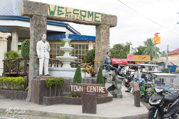
The name Anilao comes from a tiny township. In the “old days,” Anilao was where people would go to hire a local boat, park their cars and head to their private house, or maybe one of the few dive resorts that existed at that time. Eventually, the road extended further and further along the ridgeline of the peninsula, and the area began to expand. The entire area is now known as Anilao, which covers all of the dive sites within reach of the Balayan Bay, Batangas Bay, and Malicacaban island.
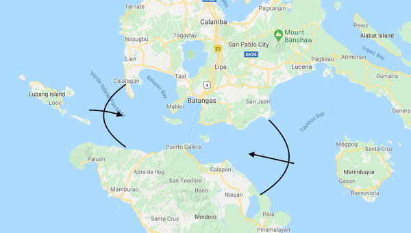
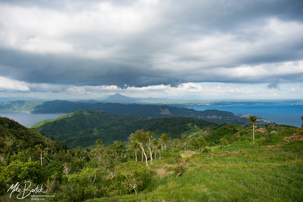
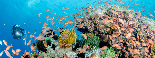
What makes the Anilao peninsula so unique is a perfect storm of natural elements combined with unique geological proportions. The combination of the nutrient-rich, ocean-driven currents of the Verde Island Passage (VIP) fed by the Western Pacific Ocean and the South China Sea, seasonal wind, and ancient volcanic activity. All of these elements clashed and fused to create something seen in very few places on the planet, and is continuously changing. The VIP separates the main island of Luzon and Mindoro and is a heavily used waterway, which plays as important a role in supporting humans as it does for marine life.
Consider the Verde Island Passage as the massive pumping heart of a complex marine bio-system. The circulation is fed by the “arteries” of ocean driven waterways. These strong tidal flows are its “blood” that exchanges gasses with the two deep-set bays as if they are massive lungs. Imagine them slowly inhaling on each incoming tide, bringing in fresh oxygenated water, then exhaling the excess of nutrients back into the main arteries of the pass to be blended back together and circulated once again.
As both of the bays (Balayan and Batangas) are deep-set, they create large eddy systems allowing planktonic subjects the opportunity to settle, shelter, feed, and gain strength, further populating the reefs. Both of these bays play an essential role by providing needed shelter for larval fish, spawning, and other crucial developmental needs of marine life both in and outside of the bays.
Steady trade winds also come into play here, blowing from the East for about four months of the year and then West for another four months. These winds push the top layers of water against the current, enhancing the already present upwellings. These natural elements work together to mix the nutrients of the colder deeper waters with the warmer surface layers, transforming the VIP into a large blender, distributing eggs, spawn, and other free-drifting organisms throughout its path. The VIP’s substrate and bays are all scarred with deep canyons, trenches, deep pinnacles, and other anomalies that, even today, are still forming by way of volcanic activity. Anilao is a wild place where anything can happen.
This main artery of water is bookended on the East by Verde Island itself and on the West by Sombrero island. East-bound currents are divided at Verde Island to form the narrow Malacaban straight, which runs parallel to the VIP until it rejoins after Malacaban island, a distance of only 8-10 nautical miles. The Malicaban straight feeds both the Batangas Bay and the Balayan Bay with a fresh supply of ocean water at every high tide cycle. Both bays refresh twice a day, with an average of about 1 meter of water on each high and low tide cycle. Water clarity here isn’t always that good due to the amount of plankton drifting through, but when it does clear up, wow, talk about crazy!
Sombrero and Beatriz:
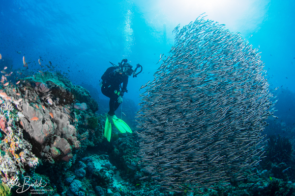
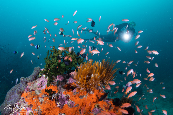
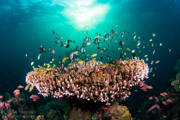
Verde Island Sits at the East end of the pass (not considered as a part of Anilao), and Sombrero Island sits at its West end. It is here at Sombrero that several current lines converge and where the divided waterways of the VIP once again reunite and combine with the tidal flow of the Balayan Bay, creating some powerful current lines during the full and new moon cycles. The area is generally shallow as it rises to meet the current. Diving at Sombrero will often stop me in my tracks. The sunlight penetrating the shallow waters and current swept walls. Schools of small triggerfish moving from one place to the next with some unknown urgency. Small barracuda, big mouth mackerels, colorful Anthias are feeding in the current, busy cleaner wrasse, yellow snappers, sea turtles, flamboyant nudibranchs, and pulsing xenia coral. Wow, it is impossible to explain it all and even harder to photograph.
While Sombrero gets its name from the shape of the small island, the reef called Beatriz is named after a woman. Rumor has it that she’s a bank teller in Manila. Not quite as exciting as my widowed bride tale, but that’s a different story!
Fully exposed to the intersecting currents, Beatriz is another area of the Sombrero Island reef complex. The main wall area and fingered canyons can create a swirling vortex style current, so caution should be exercised when diving here, but it is well worth the effort.
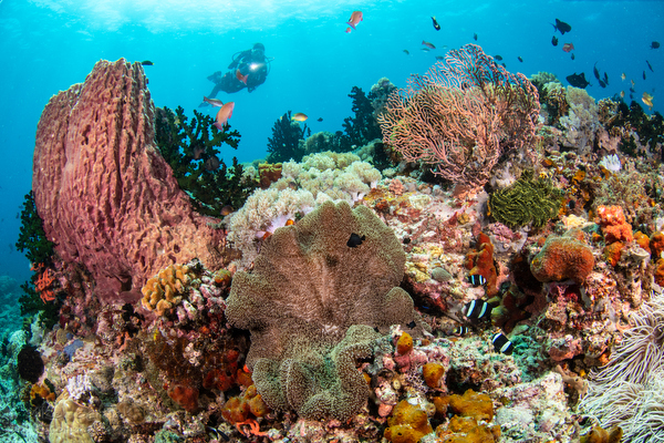
The entire Verde Island Passage is at the center of the marine biodiversity of the coral triangle. Beatriz and Sombrero are the perfect place in Anilao to get an example of what this looks like underwater. While much of the earth’s shallow reefs have been affected by global warming and coral bleaching, the cooler waters that wash over the reefs in Anilao have so far protected them. While we have seen some, it seems much more limited than some other regions.
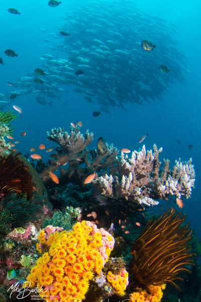
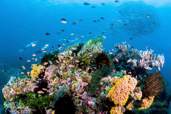
Layag-Layag and Kirby’s
Layag-Layag is named after a type of triangular sail common on the smaller single man boats in the lower Islands of Zamboanga. Which, abstractly, somehow resembles the volcanic rock on the corner of a shallow channel standing well above the dive site. This entire wedge-shaped shoulder area is lush underwater but can be challenging to dive even with the slightest of currents. These result in a one-way drift dive that will include open water ascents.
Kirbys is an all-time favorite of mine. Its basically two pinnacles, one of which protrudes from the surface. The lower pinnacle is more like an underwater island, sloping away to the depths. The reef is covered with a bright yellow sea cucumber, which seems to thrive here and no place else.
Delicate cabbage coral patches can also be found in pristine gardens near here but are more hidden in their locations.
Apohls and Mainit Corner
Apohls and the Mainit Corner are directly adjacent to each other across the Malacaban straight. Both are stellar examples of what nutrient-rich waters will do when the flow is obstructed by anything in its path.
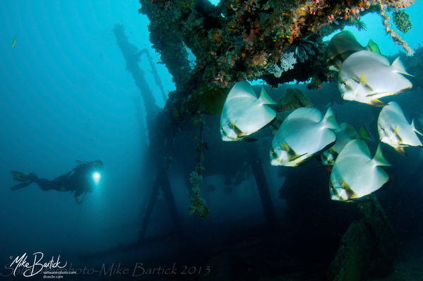
Anilao is also home to several successful Marine Protected Areas (MPA’s) that were put into place many years ago in an attempt to preserve and conserve, Twin Rocks and Arthurs namely. But there is also a great little dive park called Ligpo Island that is further back into the bay, Devils point and of course, Cathedrals. Devils point is not protected, but it is a great day trip, and probably one of the furthest dive sites making it a rarely dived destination.
The reefs in the Anilao area can offer an endless array of scenic reef images but sadly lacks in pelagic life. We do have sporadic sightings of whale sharks, mantas, mola-mola, and even thresher sharks, but this isn’t a reliable destination to see these subjects. Like anyplace, if you are there long enough, you will start understanding its true colors and be treated to some unique sightings.
Hope for the future:
While currently being considered as a UNESCO world heritage site, Verde Island has no protective measures in place against the refineries and other manufacturing activities that take place in the bays. Agricultural runoffs and grey water also play a role here with many giant companies operating with very little, if any, regulations. Please consider supporting one of the groups fighting to implement the change’s to protect this delicate and wild habitat that co-exists, just offshore.
I hope that everyone has the chance to come and dive here at some point and also hope that anyone reading this stays healthy both physically and mentally.
About the author:
Mike Bartick of Saltwater Photo is a professional underwater photographer who is widely published and also manages the Crystal Blue Dive Resort in Anilao, Philippines.